Climate Zones in the United States: What They Mean and Where You Live
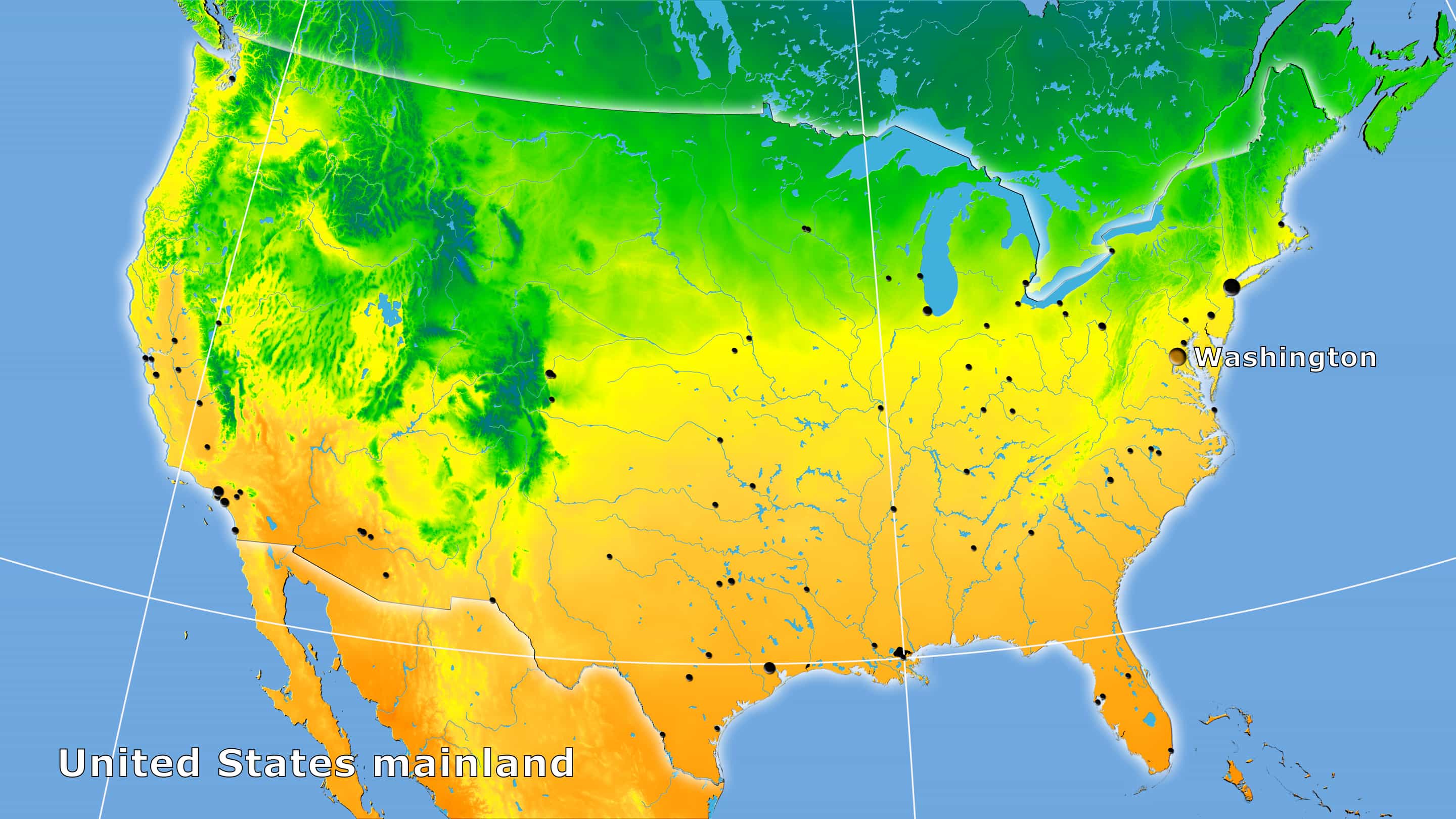
The United States is one of the most climatically diverse countries on earth. Within its borders you can find tropical heat in southern Florida, polar tundra in northern Alaska, Mediterranean sunshine along the California coast, bone-dry desert in Nevada and Arizona, and everything in between. Two cities can be in the same state and experience climates that feel like different countries.
Most people have a rough sense of where they live on the climate spectrum — hot, cold, dry, humid — but the formal classification system behind those impressions is more precise and more useful than most people realize. Climate zones determine what you can grow in your yard, how much you spend heating and cooling your home, what weather risks you face, and increasingly, how your region’s conditions may shift over the coming decades.
The standard system for classifying climates worldwide is the Köppen-Geiger climate classification, developed originally by the Russian-German climatologist Wladimir Köppen and later refined with Rudolf Geiger. It divides the world into five major climate groups, each broken into subtypes based on seasonal temperature and precipitation patterns. The United States contains examples of nearly all of them. 1
To find the specific climate zone for any ZIP code in the country, visit ZipCodePlus.com and look up your ZIP code directly.
The Five Major Climate Groups in the United States
The Köppen system uses capital letters to identify the five major climate groups. Every climate on earth belongs to one of them, and the United States contains all five — though polar climates are largely limited to Alaska and the highest mountain peaks. 1
- Group A — Tropical: Year-round warmth, no true winter, high rainfall
- Group B — Arid: Low precipitation defines the climate more than temperature
- Group C — Temperate: Mild winters, warm summers, moderate precipitation year-round
- Group D — Continental: Cold winters, warm or hot summers, four distinct seasons
- Group E — Polar: Year-round cold, no warm season
Within each group, a second letter describes the seasonal precipitation pattern, and a third letter describes temperature characteristics. The result is a two- or three-letter code that concisely describes a location’s climate. The most commonly referenced U.S. climate zones — humid subtropical, humid continental, Mediterranean, semi-arid — all come from this system. 2
The Nine Major Climate Zones of the Contiguous United States
1. Tropical (Af / Am) — South Florida, Hawaii, Puerto Rico
The tropical climate is the warmest zone in the system. Average temperatures stay above 64°F every month of the year, and there is no true winter. Annual rainfall is high — typically between 55 and 70 inches — and distributed throughout the year, often delivered by afternoon thunderstorms. 2
In the contiguous United States, true tropical climate is limited to the southern tip of Florida — the Florida Keys, the Everglades, and the Miami metro area. Hawaii, Puerto Rico, and the U.S. Virgin Islands also fall into this zone.
What it means to live there: Lush vegetation, year-round warmth, and no frost. Air conditioning is essential. Hurricane risk from June through November is significant. Outdoor plants thrive year-round, but freezing-sensitive species are native to this zone. Browse ZIP codes in Florida →
2. Humid Subtropical (Cfa) — The Southeast
The humid subtropical zone is the most populated climate zone in the United States, home to major cities including Atlanta, Charlotte, Houston, Nashville, Birmingham, and Jacksonville. 3
It covers most of the Southeast: Florida (north of the tropical zone), Georgia, Alabama, Mississippi, Louisiana, South Carolina, North Carolina, Virginia (eastern and southern portions), Arkansas, Tennessee, and parts of Texas. The zone’s northern boundary runs roughly from the Virginia/Maryland coast westward through northern Oklahoma. 2
Summers are hot and humid — daytime highs routinely reach 90°F or above, and the combination of heat and moisture makes it feel hotter. Thunderstorms are frequent. Winters are mild, with temperatures occasionally dipping below freezing but rarely staying there long. Snowfall is uncommon in most of the zone, though it does occur and can disrupt regions unequipped for it.
Annual rainfall is abundant — typically 40 to 60 inches — distributed year-round with a summer peak. Hurricane risk affects the coastal portions of this zone, particularly along the Gulf Coast and Atlantic seaboard.
What it means to live there: Long growing seasons, low utility costs for heating, high utility costs for cooling, and genuine weather variability in winter along the zone’s northern edge. Browse ZIP codes in Georgia → Browse ZIP codes in North Carolina →
3. Humid Continental (Dfa / Dfb) — The Northeast and Midwest
The humid continental climate covers the largest geographic area of any zone in the contiguous United States — stretching across most of the Northeast and Midwest, including New York, Pennsylvania, Ohio, Michigan, Indiana, Illinois, Wisconsin, Minnesota, Iowa, and parts of the northern Plains. 3
This is the classic four-seasons climate. Winters are cold with significant snowfall. Summers range from warm (in the cooler Dfb subtype, found in northern Minnesota, Wisconsin, and New England) to genuinely hot (in the warmer Dfa subtype, found in the Chicago-to-St. Louis corridor). Annual temperature swings of 50 to 70°F between summer highs and winter lows are typical. Precipitation is moderate and distributed year-round.
The Great Lakes create local climate variations — lake-effect snow dumps enormous amounts of snow on downwind communities in Michigan, Indiana, Ohio, Pennsylvania, and New York during winter months, making cities like Buffalo and South Bend among the snowiest in the country. 4
What it means to live there: Genuine seasons, including real winters. High heating costs in northern portions. Strong agricultural productivity during the growing season. Some of the country’s most affordable housing is found in this zone. Browse ZIP codes in Ohio → Browse ZIP codes in Minnesota →
4. Mediterranean (Csa / Csb) — The California Coast
The Mediterranean climate is defined by its distinctive seasonal reversal: dry summers and wet winters. It is one of the most sought-after climates in the world for livability — mild temperatures year-round, low humidity, abundant sunshine — and it occurs naturally in only a handful of regions on earth. In the United States, it is almost entirely limited to coastal and near-coastal California. 2
The warmer subtype (Csa) — hot, dry summers and mild, wet winters — covers most of coastal Southern California and the Central Valley. The cooler subtype (Csb) — warm, dry summers and cool, wet winters — covers the San Francisco Bay Area and coastal Northern California.
Annual rainfall ranges from 10 to 30 inches, nearly all of it falling between November and March. Summers can go three to five months with essentially no rain. Drought is a structural feature of this climate, not an aberration, which drives significant water management challenges and wildfire risk during dry summer and fall months. 4
What it means to live there: Exceptional outdoor livability. Low heating and cooling costs in coastal areas. Wildfire risk in dry inland and foothill areas. Drought conditions require water-conscious landscaping and gardening practices. Browse ZIP codes in California →
5. Oceanic / Marine West Coast (Cfb) — The Pacific Northwest
The oceanic climate of the Pacific Northwest is defined by its remarkable moderation — mild, grey, wet winters and pleasantly cool, dry summers. Unlike most of the country, temperature extremes in both directions are rare. Seattle, Portland, and the coastal communities of Washington and Oregon are the signature cities of this zone. 2
Annual rainfall in the maritime portions of this zone is high — Seattle averages around 38 inches per year — but most of it falls as gentle drizzle rather than dramatic storms. The Cascade Mountains create a dramatic rain shadow: the wet oceanic climate exists west of the Cascades, while the east sides of Washington and Oregon have entirely different, semi-arid climates.
Summers are dry and mild — daytime highs typically in the 70s°F — making them some of the most pleasant in the country. Winters are rarely bitterly cold, but grey skies and persistent drizzle from October through May are a defining feature of life here.
What it means to live there: Limited need for air conditioning. Moderate heating costs. Excellent gardening conditions for a wide range of temperate plants. Grey winters affect some residents significantly. Browse ZIP codes in Washington → Browse ZIP codes in Oregon →
6. Semi-Arid / Steppe (BSk / BSh) — The Great Plains and Intermountain West
The semi-arid or steppe climate covers the largest continuous area of the contiguous United States — stretching across most of the Great Plains from Montana and the Dakotas south through Kansas, Oklahoma, and into Texas, and continuing through much of the Intermountain West including parts of Idaho, Wyoming, Colorado, Utah, and Nevada. 3
Precipitation is low — typically 10 to 20 inches annually — but enough to support grassland rather than pure desert. Temperature extremes are significant: hot summers, cold winters, and dramatic daily temperature swings. The Great Plains version (BSk, cold semi-arid) experiences brutal winter blizzards and severe summer thunderstorms. Tornado Alley — the most tornado-prone region in the world — cuts through the southern portion of this zone across Kansas, Oklahoma, and Texas. 4
What it means to live there: Low cost of living in most of this zone. Significant weather variability, including tornado and severe storm risk. Excellent for dryland farming and ranching. Water availability is a long-term concern in many parts of this zone as aquifer levels decline. Browse ZIP codes in Kansas → Browse ZIP codes in Colorado →
7. Hot Desert (BWh) / Cold Desert (BWk) — The Southwest
The desert climate occupies the southwestern United States — Nevada, Arizona, and parts of California, Utah, and New Mexico. It is defined by extreme aridity: annual precipitation below 10 inches and sometimes far less. 2
The hot desert subtype (BWh) covers the low-elevation Sonoran Desert of Arizona and California’s Coachella Valley. Phoenix averages less than 8 inches of rain annually and experiences more than 300 days of sunshine per year. Summer temperatures regularly exceed 110°F. The cold desert subtype (BWk) occurs at higher elevations in Nevada and the Great Basin, where winter temperatures drop significantly despite similar aridity.
Despite its harsh conditions, this zone has seen extraordinary population growth — Phoenix, Las Vegas, and Tucson are among the fastest-growing metros in the country. Air conditioning has made desert living viable at scale, though water scarcity is an increasingly critical constraint on continued growth. 4
What it means to live there: Extraordinary sunshine, very low humidity, and minimal rain. Air conditioning is not optional — it is life-critical in summer. Water costs and availability are important long-term considerations. Wildfire risk is lower in the pure desert than in surrounding semi-arid zones, but flash flooding from monsoon rainfall can be significant. Browse ZIP codes in Arizona → Browse ZIP codes in Nevada →
8. Highland / Mountain (H) — The Rockies, Sierra Nevada, Appalachians
Mountain climates do not fit neatly into the standard Köppen letter categories and are often designated separately as highland climates. They occur wherever elevation creates conditions dramatically different from the surrounding lowlands — primarily in the Rocky Mountains, the Sierra Nevada, and to a lesser extent the Appalachians. 1
The defining feature is elevation-driven climate variation: temperatures drop approximately 3.5°F for every 1,000 feet of elevation gain, precipitation increases with altitude, and snow at high elevations persists long after the valleys below have thawed. A mountain community at 8,000 feet in Colorado experiences an entirely different climate than Denver at 5,280 feet, despite being only miles apart.
Outdoor recreation access — skiing, hiking, mountain biking — is a primary draw for residents in this zone, and many of the country’s highest-demand small city real estate markets (Aspen, Bozeman, Jackson Hole, Lake Tahoe) sit in highland climate areas. Browse ZIP codes in Colorado → Browse ZIP codes in Montana →
9. Subarctic and Polar (Dfc / ET) — Alaska
Alaska encompasses the most extreme climate range of any U.S. state. The interior — around Fairbanks — has a subarctic climate with some of the coldest recorded temperatures in North America, regularly reaching -40°F or below in winter. The southeast panhandle around Juneau has a cool oceanic climate. Northern Alaska’s Arctic slope has a true polar tundra climate with permafrost, no real summer, and temperatures that can fall below -60°F in extreme cold snaps. 2
What it means to live there: Extraordinary wilderness access, summer midnight sun, and genuine frontier conditions in remote areas. Infrastructure costs and logistics in rural Alaska are unlike anywhere else in the country. Browse ZIP codes in Alaska →
Why Your Climate Zone Matters Beyond Weather
Most people think of climate zones as a weather question. But the implications reach much further.
Home energy costs. Heating-dominated climates (humid continental, subarctic) drive high annual natural gas and heating oil consumption. Cooling-dominated climates (humid subtropical, hot desert) drive high electricity consumption for air conditioning. Understanding your climate zone is step one in estimating what you will actually spend on utilities in any given location.
Home insurance. Hurricane risk (tropical, humid subtropical coastal zones), tornado risk (semi-arid Great Plains), wildfire risk (Mediterranean, mountain, and desert zones), and flood risk all correlate with climate zone. Insurance costs in high-risk zones have risen dramatically in recent years. 4
Gardening and landscaping. Your climate zone determines what plants will survive your winters and thrive in your summers. This is why the USDA Plant Hardiness Zone — which divides the country based on minimum winter temperatures — is published at the ZIP code level and directly tied to climate zone data. To find your USDA Plant Hardiness Zone, look up your ZIP code at ZipCodePlus.com, or read USDA Plant Hardiness Zones Explained.
Agriculture and food production. Growing seasons, frost dates, rainfall patterns, and temperature extremes all determine what can be grown economically in any region. Climate zone is the foundation of regional agricultural character.
Long-term climate trajectory. Climate zones are not static. Research tracking the Köppen classification over time has documented measurable northward shifts in climate zone boundaries — areas previously classified as humid continental showing characteristics of humid subtropical, Mediterranean zones expanding, and arid zones creeping into formerly semi-arid territory. Where a ZIP code sits climatically in 2026 may be different from where it sat in 1990, and projections suggest continued shifts. 1
Finding Your Climate Zone by ZIP Code
Every ZIP code page on ZipCodePlus.com includes the climate zone for that location alongside demographics, income data, housing costs, sales tax rates, and USDA plant hardiness zone. If you are researching a potential move, comparing neighborhoods, or simply curious about the climate classification of where you live, look up the ZIP code directly.
A few examples to explore:
- ZIP code 33139 — Miami Beach, Florida → — Tropical
- ZIP code 30301 — Atlanta, Georgia → — Humid Subtropical
- ZIP code 60601 — Chicago, Illinois → — Humid Continental
- ZIP code 90210 — Beverly Hills, California → — Mediterranean
- ZIP code 85001 — Phoenix, Arizona → — Hot Desert
- ZIP code 98101 — Seattle, Washington → — Oceanic
Related Reading
- USDA Plant Hardiness Zones Explained
- Best States for Families to Move to in 2026
- Remote Work and Relocation: Where Americans Are Moving for Lifestyle
- How to Research a ZIP Code Before You Move
Sources
Page last updated: April 2026. Climate zone classifications based on Köppen-Geiger system using 1991–2020 climate normals. Zone boundaries are approximate and can vary at local levels due to elevation, proximity to water, and urban heat effects. Individual ZIP code climate data available at ZipCodePlus.com.
Footnotes
-
Britannica — ‘Köppen Climate Classification,’ updated March 2026. https://www.britannica.com/science/Koppen-climate-classification ↩ ↩2 ↩3 ↩4
-
PlantMaps — ‘United States Köppen-Geiger Climate Classification Map,’ updated April 2026. https://www.plantmaps.com/koppen-climate-classification-map-united-states.php ↩ ↩2 ↩3 ↩4 ↩5 ↩6 ↩7
-
Wikipedia — ‘Climate of the United States,’ citing NOAA and Köppen-Geiger classification data. https://en.wikipedia.org/wiki/Climate_of_the_United_States ↩ ↩2 ↩3
-
Map United States — ‘U.S. Climate Zones Map — Köppen Classification & Regional Climate.’ https://mapunitedstates.com/maps/climate-zones/ ↩ ↩2 ↩3 ↩4 ↩5